Engineering and technical consultancy
Measure, design,
control.
Surveying, hydraulics, infrastructure and training. Studies that guide and justify the technical choices of a project, from the field survey to the supervision of the works, in Mali and abroad.
Mine surveying
Compute volumes, mark ore,
track the pit.
GNSS surveys of the pit and stockpiles, volume calculations for ore and waste rock, ore boundary marking in the field.
Structural monitoring
Checking
what has been built.
Total station readings on control points to verify the stability of bridges and other engineering structures.
Professional training
Passing on the tools
and the methods.
Classroom theory, then practice in the field: GIS, remote sensing, DGPS and total station, with the equipment we actually use on assignments.
A consultancy for
engineering studies,
training and surveys.
GEOD CONSULT produces the studies that guide and justify the technical and structural choices of a project. Led by a managing director, the company brings together engineers and technicians with complementary specialities, organised into four technical departments.
“Recommend on the basis of calculations, propose solutions for carrying out the works, and assess the quality of what has been built.”
Technical departments
- Study and design
- 01
- Implementation
- 02
- Monitoring and evaluation
- 03
- Training
- 04
Support
- Administration
- secretariat, accounting
- Support staff
- site supervision, workers
Four fields
of expertise.
From data acquisition to the inspection of the finished structure, with the same teams
and the same equipment.
Surveying, land & GIS
- Surveys and setting-out
- Classical and satellite geodesy
- Cadastre and land subdivision
- Mapping, GIS, remote sensing
- Mine surveying
Water & environment
- Hydrology, hydraulics, hydrography
- Boreholes and drinking water supply
- Sanitation, underground networks
- Irrigation schemes
- Environmental and gender studies
Infrastructure & civil engineering
- Roads, bridges, engineering structures
- Urban and rural roads and utilities
- Buildings and steel structures
- Special foundations and soundings
- Electrical works
Advisory & project support
- Monitoring and evaluation
- Field surveys and data collection
- Expert appraisals and diagnostics
- Public procurement
- Project management
Four stages, from
the field to handover.
Study and design
Site reconnaissance, surveys, calculations and sizing. Our recommendations rest on measured data, not on estimates.
Implementation
Setting-out, management of the works and coordination of all parties on site.
Monitoring and evaluation
Compliance checks, structural monitoring, and an overall review of the quality of the completed works.
Training
Skills transfer to the client’s teams, covering both the tools and the methods.
We own
our instruments.
A consultancy that owns its equipment keeps control of its lead times and costs. Ground, airborne and bathymetric data acquisition, processed with industry-standard software.
Recent
assignments.
Three assignments representative of the company’s scope of work.
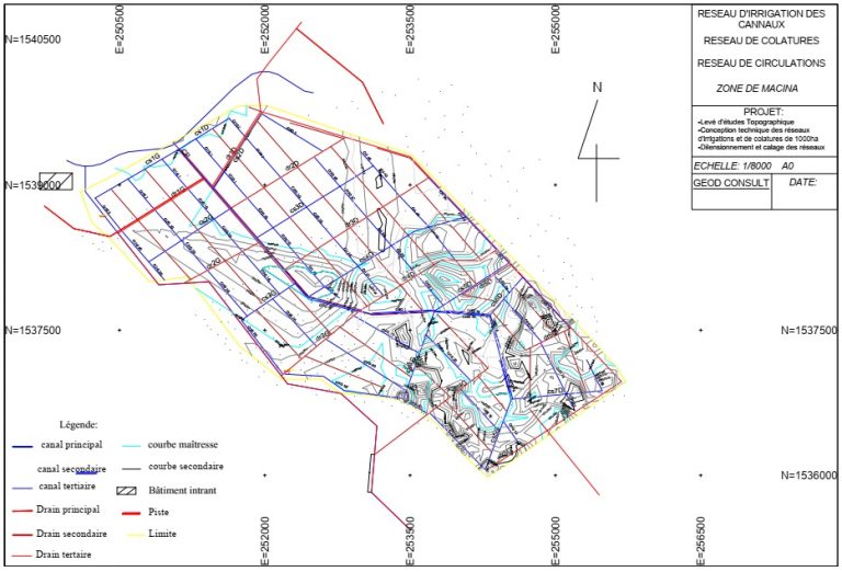
Agricultural irrigation scheme at Macina
Client: IGIP-MALI — May 2025

Survey monitoring at the Nampala mine
Pit and stockpile surveys, volume calculations, ore boundary marking.
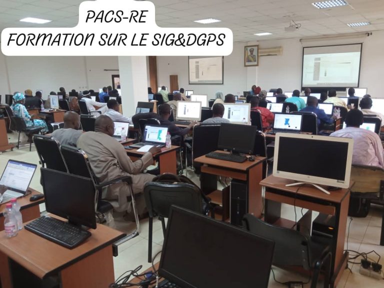
GIS & DGPS workshop for water sector staff
Client: Direction nationale de l’hydraulique (DNH), Mali’s national water directorate — October 2023
A survey, a study, an
inspection? Let’s talk.
Quotation within two working days of receiving the terms of reference.